
Mission ZIP Code Coverage
Mission’s verified postal set has three five-digit Census ZCTAs that are fully or partly within the city: 78572, 78573, and 78574. That is the documented starting set for a Mission postal search, not a neighborhood-by-neighborhood delivery map. The Census profile establishes the ZCTA relationship. USPS establishes the ZIP assigned to one delivery address. The research did not locate a complete official list of Mission neighborhoods by ZIP, a ZIP split chronology, or a verified table of addresses outside the city that use a Mission postal label.
| ZIP | Areas Covered | Post Office | Notes |
|---|---|---|---|
| 78572 | Census ZCTA fully or partly within Mission | Mission Post Office, 901 N Francisco Ave | USPS assignment is address-specific; ZCTA is not an exact delivery boundary. |
| 78573 | Census ZCTA fully or partly within Mission | Verify the address with USPS; no separate Mission station was located | Do not assume every 78573 address lies inside Mission city limits. |
| 78574 | Census ZCTA fully or partly within Mission | Verify the address with USPS; no separate Mission station was located | Do not infer incorporated-city coverage from a postal city label. |
The Census Mission profile is the source for the ZCTA context used to build this table.
Census ZCTAs are useful for area statistics and broad geography. They do not replace USPS when the question is the ZIP for a single street address.
Mission ZIP Geographic Layers
Postal ZIPs, Census ZCTAs, city limits, school districts, county precincts, and parcels are different geographic layers in Mission. A Mission ZCTA is a Census statistical area built from census blocks. It can be noncontiguous and can include geography that does not correspond exactly to a USPS delivery ZIP. Mission also sits in Hidalgo County, whose county seat is Edinburg. That county relationship does not make a county boundary, city boundary, or postal boundary interchangeable.
For Mission ZIP code research, use the layer that matches the question. USPS answers delivery routing for an actual address. The Census profile provides ZCTA context. Mission city and county GIS layers show municipal and parcel geography. CAD identifies a Mission assessment account, while the County Clerk’s legal description supports a recorded-property history. A postal-city field is useful, but it is not a finding that the property sits within the incorporated City of Mission.
Note: Census ZCTA boundaries are useful Mission context, but USPS remains the source for a specific delivery assignment.
Check a Mission ZIP Address
Finding Mission residents by ZIP begins with verification, not a broad people list. Enter the exact Mission street address in USPS lookup. Record the returned ZIP and postal city without substituting a city-limit label. Next, compare the address point and parcel polygon with the city-limit, incorporated-community, and precinct layers. Only after that should an address be searched in CAD or the Tax Office. The legal description or account then gives the County Clerk index a durable property key.
- Use USPS to verify the exact street address and write down the returned ZIP and postal city.
- Compare the address point, parcel, city-limit, community, and precinct layers in the Mission or Hidalgo GIS route.
- Search Hidalgo CAD using the number and street name without directional prefixes or suffixes.
- Use the Tax Office’s Property Address (Starts With) choice to narrow a street term when appropriate.
- Carry the account or legal description into the County Clerk official-records portal for recorded-property history.
- For older context, check verified newspaper, directory, map, and archive holdings by street and era.
USPS address lookup is the documented delivery-verification tool for the first step.
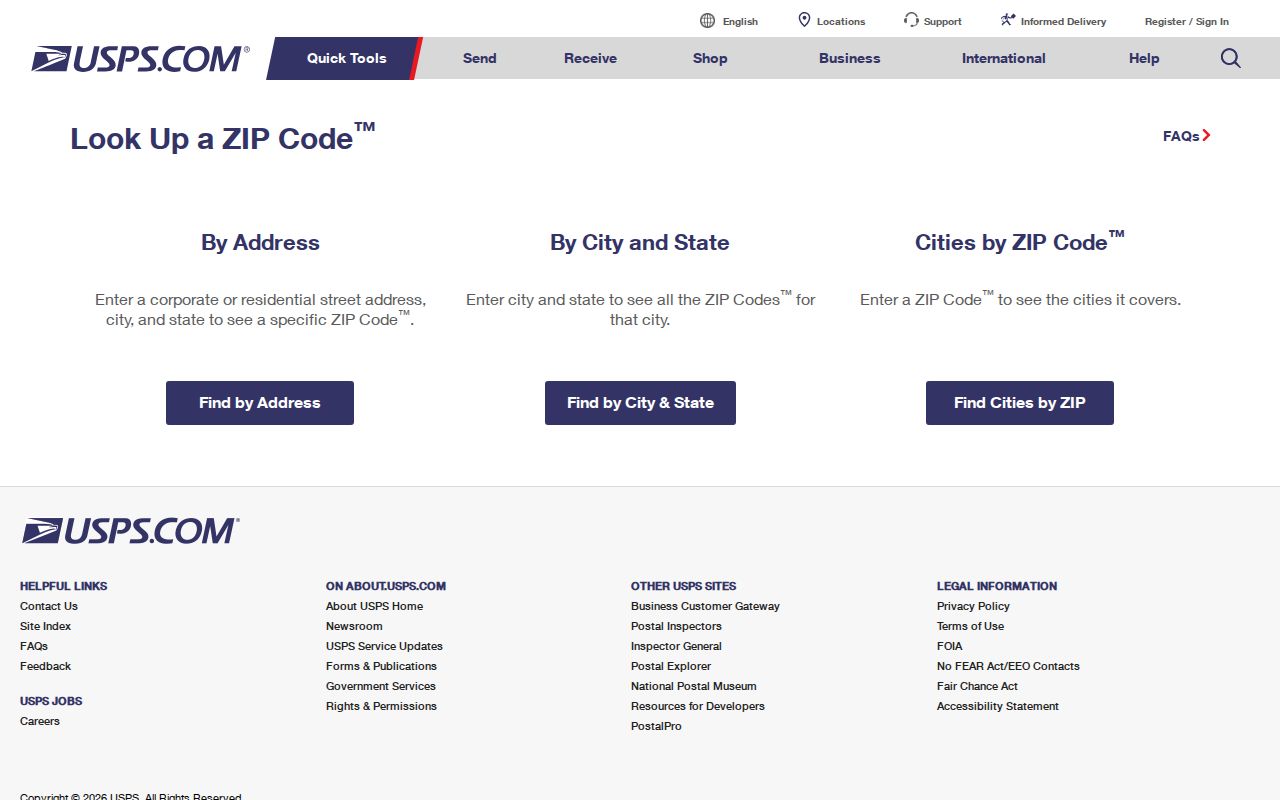
Once USPS narrows the mailing route, the street-level parcel and deed chain belongs in the Mission by-street directory. ZIP alone is too broad for a property-history conclusion.
Mission ZIP Search Fields
No reviewed Hidalgo CAD, Tax Office, city GIS, county ArcGIS, or statewide voter-file form exposed a Mission ZIP filter. That absence is useful information. No Mission local lookup can honestly promise a one-click property or voter search by ZIP when the documented public forms do not provide that field. Instead, verify the ZIP with USPS, then use an address, account, legal description, county, district, or precinct field as the relevant system allows.
| Tool | Documented fields or layers | ZIP role | Verified constraint |
|---|---|---|---|
| USPS address lookup | Exact street address in the documented workflow | Returns the delivery ZIP and postal city for that address | Use it for delivery verification, not city-limit mapping. |
| Hidalgo CAD | Owner name, number plus street name, exact account | Address-to-parcel step after USPS verification | No ZIP filter exposed in the reviewed form. |
| Hidalgo Tax Office | Owner, Property Address (Starts With), account, CAD reference, fiduciary number | Can narrow a street or account search | No ZIP field exposed in the reviewed form. |
| Mission and Hidalgo GIS | Address points, parcels, city limits, communities, floodplain, precincts | Compares postal routing with geography | No documented ZIP-wide parcel query captured. |
| State voter-file request | County, district, precinct, and selected reduction fields | Possible formal records route | Inspected form did not show a Mission ZIP filter. |
A Texas Public Information Act request can ask a custodian for an existing ZIP or address-field output if the office maintains one. Privacy, cost, and records rules still apply, and the request does not require the custodian to create a new ZIP-based list.
Mission ZIP Search Tip
Insider tip. Separate a property’s situs, an owner’s mailing address, and its legal description before building a ZIP search result. A 78572 mailing address can belong to an owner of property in another ZIP. A property using a Mission postal city can sit outside incorporated Mission. A post-office box is not a residence. CAD connects an assessment record to a situs or account, and the County Clerk connects a legal description to a recorded instrument. Neither should be replaced by a mailing label.
Historical reverse directories may arrange entries by address, but their city, title, and year need verification. The research did not locate a verified Mission reverse-directory run. For historical occupants, the Speer newspaper archive, library reference route, and TSLAC or UTRGV holdings are safer documented paths than assuming that an address directory covers every era.
Note: Preserve the postal city returned by USPS even when GIS shows a different city-limit relationship.
Mission ZIP Property Clues
Hidalgo CAD accepts a Mission address as number plus street name and an owner name in surname-first form. The Tax Office offers a first search term with owner, property address, account, CAD reference, or fiduciary choices, plus an optional second term. Those tools help move from a verified ZIP to a Mission parcel or assessment account. They do not expose a public ZIP filter in the reviewed forms, and the static CAD capture did not reveal the full set of parcel-card labels, historical coverage, paging, export, or fees.
Use the returned Mission account or legal description in the County Clerk portal. Its Quick Search can take a grantor or grantee, subdivision, document type, or document number; Advanced Search includes party roles, dates, book, volume, page, lot, block, and legal-description fields. That sequence turns a ZIP into a Mission property-record trail without mislabeling a postal route as ownership or residency.
Mission ZIPs and City Limits
Mission city limits and postal ZIP boundaries do not share one universal edge. The Census profile says the 78572, 78573, and 78574 ZCTAs are fully or partly within Mission. It does not prove every address in any one code is inside the city. USPS should verify the delivery address, while GIS should compare the address point and parcel with city-limit and incorporated-community layers. That distinction is especially important when a property is near a city or county boundary, or when an owner receives notices at a different address.
No official source reviewed identified the complete set of outside-city addresses using a Mission postal label, a ZIP realignment year, or ZIP-level voter-registration totals. Do not complete the Mission map with guesses. The right Mission record trail is USPS for delivery, Census for ZCTA statistics, GIS for municipal geography, CAD for the assessed parcel, and the County Clerk for the legal history.
Note: No verified Mission ZIP split or realignment history was located in the reviewed official sources.
Mission ZIP Terms Defined
Postal terms describe delivery routing. Property records use other identifiers. Keeping them separate prevents a Mission ZIP search from claiming more precision than the source supports.
- ZIP and ZIP+4
- A five-digit ZIP is a postal routing code; the added four digits refine delivery routing beyond that five-digit code.
- PO-box ZIP
- A ZIP associated with post-office-box delivery, which does not identify a residence location.
- Unique ZIP
- Postal geography used for a single organization or address grouping; it may not operate like a broad neighborhood code.
- Carrier route
- A postal delivery-route classification, not a city-limit or parcel boundary.
A ZCTA is different again: it is Census geography built from blocks, not USPS’s exact delivery boundary. Keep postal, Census, municipal, and parcel labels in separate columns or notes.
Mission ZIP History Sources
ZIP filtering is a modern routing tool, so older Mission research usually begins with an address, legal description, map sheet, or historical place name instead. TSLAC’s Hidalgo guide documents deed records from 1852 to 1888, a deed supplement from 1880 to 1912, Spanish-transcribed deed material from 1852 to 1896, and tax-roll microfilm from 1852 to 1910. The current Clerk portal is certified through August 24, 2026 but does not state an earliest online year. UTRGV Edinburg is the listed regional depository for the historical county route.
Mission’s documented local-media layer is also useful for an era search. The Speer archive includes Mission Times from 1901 to 1970, The Mission Times from 1923 to 1962, Progress Times from 1984 to 2016, and other Valley titles. A newspaper notice, map, or directory line needs its own date and context. None provides a complete ZIP-based resident list for a historic period.
Mission ZIP Post Office Check
The verified Mission retail office is the Mission Post Office at 901 N Francisco Ave, Mission, TX 78572-9998, phone (956) 585-1481. The USPS location page lists retail hours as Monday through Friday 8:30 a.m. to 5:00 p.m., Saturday 9:30 a.m. to 12:30 p.m., and Sunday closed. Nearby Hidalgo County offices exist, but the reviewed source does not establish their service territories or prove that other postal labels serve Mission addresses.
The USPS Mission Post Office record supplies the verified office details.
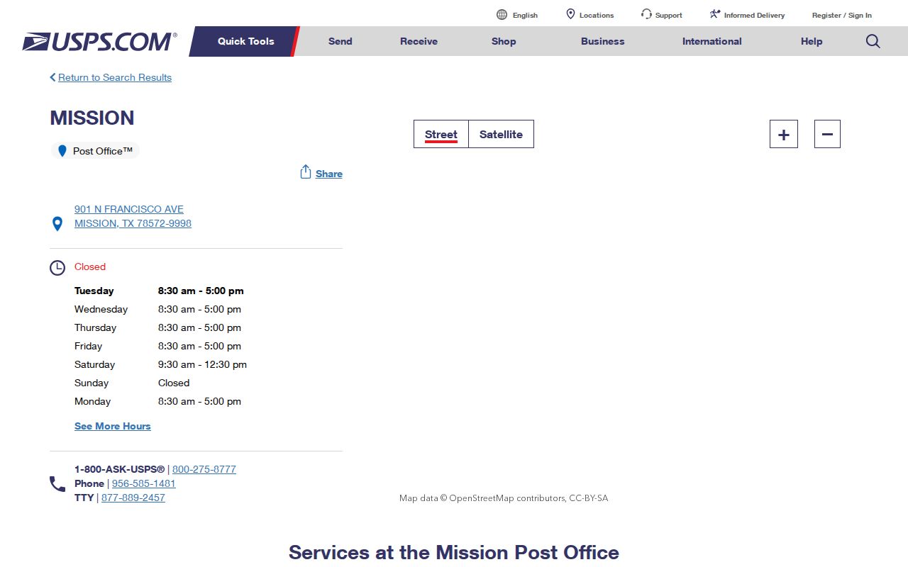
The office listing is a postal-service reference. Use the address lookup, not a general assumption about the office, to verify the ZIP for a particular Mission address.
Note: The listed Mission office does not establish delivery territory for every Mission postal address.
Mission ZIP Research Limits
For Mission, a ZIP narrows an address trail, but it cannot identify every resident, prove a current household, or resolve a parcel boundary by itself. Mailing addresses can differ from situs addresses, protected election information has statutory limits, and a formal records request has its own privacy and cost rules. For personal, lawful research, state the source and date clearly, verify the precise record with its custodian, and never use an address trail to stalk, harass, intimidate, or harm anyone.
Mission postal, parcel, election, and recorded-property sources remain separate. Match the Mission source to the question, then confirm a time-sensitive record with the office that keeps it.