
Mission Previous Residents Sources
Previous residents are not supplied by one county list. For Mission previous residents, the strongest trail changes by era and by the question being asked. A current parcel record can lead to an owner of record, but it does not prove who occupied the home. A deed documents a transfer, not every household between transfers. Newspapers, census schedules, and a verified directory can add household clues. Keep the source’s limits beside its useful detail, especially when the current online index does not state its earliest coverage year.
| Source | Years it covers | Where held | What it shows |
|---|---|---|---|
| Hidalgo Clerk official-records portal | Certified through 08/24/2026; earliest online year not stated | Online County Clerk portal | Modern deed and index route; use legal description and party roles |
| Hidalgo direct and reverse deed index | 1852–1888 | TSLAC or UTRGV microfilm | Grantor-grantee and legal-description trail |
| Deed supplement and Spanish transcriptions | 1880–1912; 1852–1896 | TSLAC or UTRGV microfilm | Additional and language-specific older deed route |
| Mission Times | 1901–1970 | Speer digital newspaper archive | Address notices, obituaries, clubs, and business clues; check OCR |
| Federal census | Public schedules through 1950 | Federal genealogy sources | Household snapshot with period geography |
| Mission Sanborn map item | Created and published 1933–1949 | Library of Congress digital item | Building, block, and street context, not a resident list |
| Mission permits | No public year range located | Mission Inspections through a PIA request | Construction or remodel dates if an existing file is available |
Begin with Hidalgo CAD when the street address is current enough to identify an account and legal description. Use the County Clerk portal for the recorded transfer. For an older gap, move to TSLAC or the UTRGV Edinburg depository rather than claiming that an unreturned online search proves the chain ended. Speer Memorial Library, the Mission Historical Museum, and FamilySearch’s Mission center are additional research channels for newspaper, family, and local-history context.
Mission Address Starting Points
Hidalgo CAD accepts owner-name, address, and exact account searches. Its documented address tip is specific: enter the street number and name, leaving off directional prefixes and suffixes. A search for “123 NE Main Ave,” for example, should be retried as “123 Main.” The returned situs, owner spelling, account, and legal description are the bridge to the title search. The separate Hidalgo Tax Office interface can search a property address that starts with a term and can use an optional second term to narrow a result.
Record four things separately: the situs, where the parcel stands; the mailing address, where tax notices go; the legal description, usually a subdivision, lot, block, or metes-and-bounds description; and the deed parties. A mailing address may belong to a post-office box, agent, former home, or owner of multiple parcels. A homestead indicator can support an owner-occupancy inference, but it is not a complete current household count.
Mission Deed Chain Steps
The County Clerk’s advanced official-records search is the documented online route for a backward chain. It offers property-record and plat departments, party-name controls for grantor and grantee, recorded and instrument date ranges, document types, document numbers, book, volume, page, lot, block, legal description, and document-image phrase fields. Party names use the LASTNAME FIRSTNAME form. Quick Search can use a grantor, grantee, subdivision, document type, or document number, while the Index Only and full-text OCR scopes should not be confused.
- Use CAD to write down the current owner, account, subdivision, lot and block, and legal description.
- Find the current owner as grantee in the Clerk index, then match the date and legal description before opening an image.
- Read the prior grantor, or seller, from the matched deed and search that person as a grantee in an earlier period.
- Repeat the role change backward, keeping document number, book or page, instrument type, and parcel description with each link.
- Check correction deeds, releases, probate transfers, divorce orders, tax sales, foreclosures, estate names, and plats when a simple warranty-deed sequence breaks.
- Move to TSLAC or UTRGV reels when the modern portal does not supply the earlier record.
County Clerk staff can provide certified copies and explain the appropriate department. The documented county contact for property e-recording and court copies is (956) 318-2100. Official public pages reviewed did not state public-terminal hours, copy fees, or certification fees, so confirm those details with the Clerk. The online page’s certified-through date is current status, not an online starting year.
- Grantor
- The party transferring an interest in a deed.
- Grantee
- The party receiving the interest named in a deed.
- Chain of title
- The documented sequence of transfers connected by the same parcel or legal description.
- Legal description
- The lot, block, subdivision, or metes-and-bounds description used to distinguish land more reliably than changing street text.
Mission Previous Residents Microfilm
The historical cutoff is an important limit. The online County Clerk portal does not publish its earliest indexed or imaged year. TSLAC’s Hidalgo inventory instead documents deed records from 1852 through 1888 with direct and reverse surname indexes, a deed supplement from 1880 through 1912, and Spanish-transcribed deed material from 1852 through 1896. It also identifies older marriage, probate, court-minute, and tax-roll groups. For a parcel that disappears from a portal result, those reels are the documented older route.
Open the TSLAC Hidalgo County historical microfilm inventory before requesting a reel.
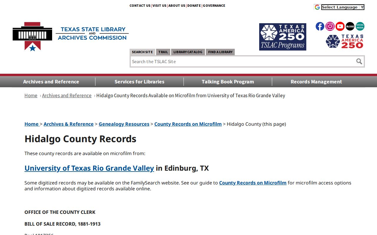
The inventory names the record groups and date ranges, letting a search move from a known legal description to the correct historical reel instead of relying on a guessed online cutoff.
Direct indexes are organized to find a recorded party, while reverse indexes follow the opposite party role. TSLAC assigns reels by surname range for the deed indexes, so consult the inventory’s exact reel assignment before making a request. Probate minutes are not indexed, and some case papers were not filmed. An index gap is an access limit, not proof that no historical record exists.
Mission Address Era Ladder
A house history gains strength when the sources overlap. The question of who lived here before needs a short chronology, not a single transfer treated as a full occupancy history. The flow is parcel and CAD account, then recorded deed, then the prior deed party, then older microfilm where needed. Around each dated transfer, look for a verified directory, census, newspaper page, tax roll, map, or probate file. Each source answers a narrower question.
- Anchor the chain with the current account and its legal description.
- Place a deed date beside the closest confirmed newspaper or directory year.
- Pair that local source with the nearest released census, which is public through 1950.
- Check a map, plat, or lot and block when the printed address appears to change.
- Use a probate or obituary item as a relationship clue, then verify the underlying record with its custodian.
The strongest conclusion is usually modest: a document connects a named party, date, and parcel; a separate dated source may connect a person to an address. It takes more than a deed to show a household, and more than an address mention to show ownership. The process keeps those evidence types from being merged.
Mission Sanborn Address Evidence
The Library of Congress Mission Sanborn map item was created and published from June 1933 through May 1949, with an item date of 1949. It offers public-domain digital images and an IIIF route. Sanborn maps show building footprints, materials, use, streets, and blocks. They do not name every resident. Use the index sheet first, then inspect the relevant property sheet and compare it with the legal description and later parcel evidence.
Shary Heights is a useful Mission-area development example, not a shortcut for every parcel. The research records its establishment on September 1, 1945, homes built by Mission residents beginning in 1947, and irrigation canals that remained until the mid-1980s. For an address in or near a historically named area, this kind of development context can help explain when a building or street layout appears. It cannot identify a past household on its own.
Mission Past Household Trail
Household evidence begins after the deed chain, not before it. Past residents may appear in the Speer archive through a name, street, obituary, civic notice, school item, church reference, or property notice. A released census schedule offers a period household snapshot, but its enumeration geography can differ from today’s Mission boundary. Search surname-first, with initials and alternate Spanish or Anglicized forms, and inspect images because OCR may alter accents and abbreviations.
Exact Mission city-directory years and reverse or criss-cross volumes were not verified online. A regular directory may connect a name to an address, while a reverse volume may connect an address to an occupant. Both need a confirmed local title and image. The collection routes, access limits, and entry-reading method are covered in the Mission city directories section. Pair an entry with a deed date and census period rather than treating it as a permanent household record.
Obituaries and probate may bring a trail to an endpoint by naming survivors, an executor or administrator, relationships, or a last residence. They are leads that should be checked against the county clerk or archive. A person named in an obituary or probate file is not necessarily someone who lived at the subject address.
Mission Address Continuity Limits
Exact street text is a weak key when a record trail crosses decades. Directional prefixes, abbreviations, annexation, subdivision renaming, rural-route descriptions, and city or county boundary changes can make one parcel look like several addresses. No official source reviewed documented a Mission-wide street renumbering or a specific street-rename year. When a search breaks, return to the plat, parcel, legal description, lot and block, neighboring streets, old map sheets, and documented owner chain.
Mission Planning and Inspections can provide address-related construction evidence through a Texas Public Information Act request when an existing file is available. No public field-complete permit or code-case search was located. Send the City Secretary the street address, account or lot and block, date range, and permit type. The Mission Inspections source identifies the types of building and remodel review that may be relevant.
Mission House History Use
Previous residents research is most reliable when it stays focused on a parcel’s documented history, family history, estate questions, or local history. A record may be open yet still incomplete, dated, or limited to the party who filed it. Texas voter, DMV, utility, and protected-address information are not substitutes for a house-history record. Keep the difference between a recorded owner, a mailing address, and a household member clear in every note.
For records not posted online, Texas Public Information Act requests can seek existing government records, subject to disclosure exceptions, cost rules, and deadlines. The Act does not override confidentiality protections. A precise request for a dated permit file, recorded instrument, or existing city record is more useful than a request asking an office to identify everyone who lived at an address.